AI-Powered Tour Inspection
About Us
Application Solutions
Typical Applications

EN

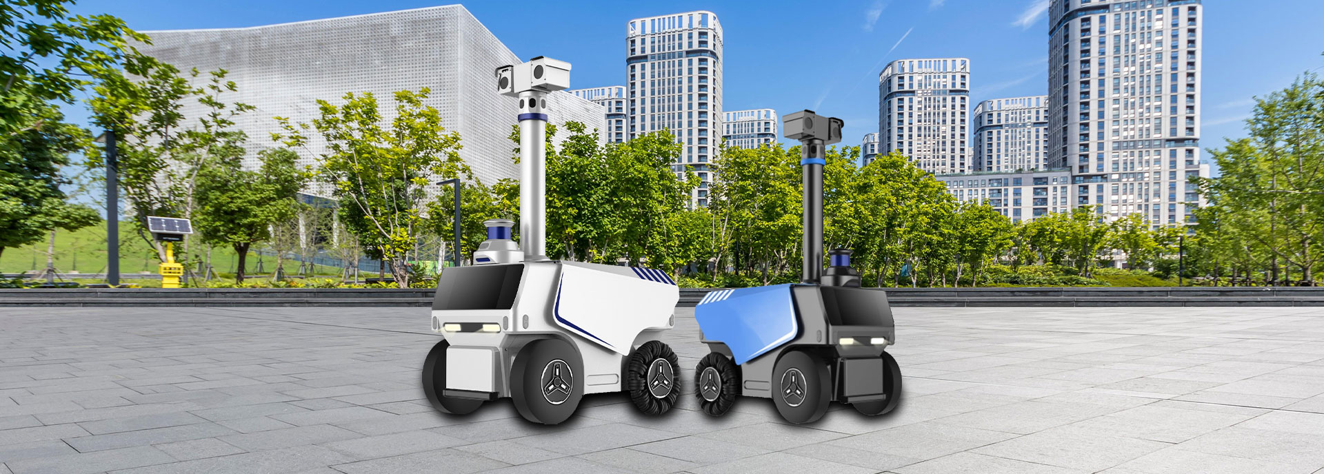
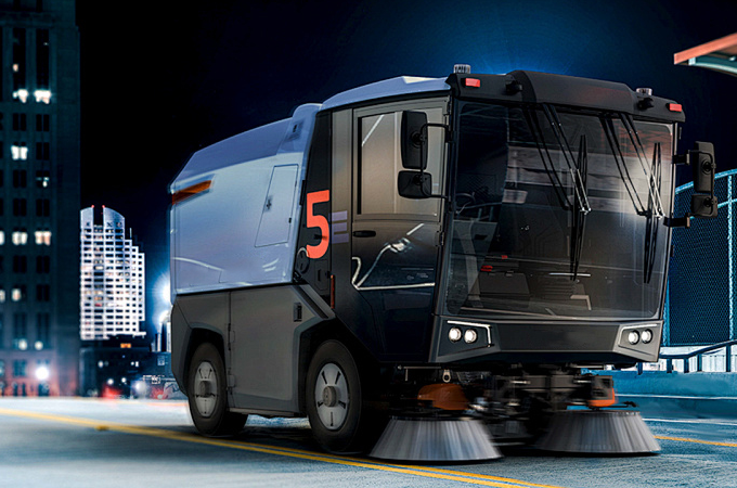
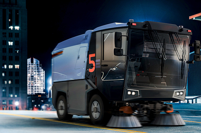
Vehicle-Mounted Tour Inspection [Badao]
When the vehicle is driving, the high-performance real-time detector that is delicately mounted on the tour inspection vehicle may gather the road surface data in real time at a pace of milliseconds. It does thorough analysis in real time and provides precise detection findings right away. Because of its integrated waterproof construction, the unit is resistant to inclement weather and challenging road conditions. Its distinctive exterior structure is ingeniously incorporated into the vehicle body without taking up any inside space, significantly improving the vehicle’s usefulness and ease of tour inspection.
Functional Advantages
Lightweight Deployment
Plug-and-play, no significant modifications are needed. The on-board host may be swiftly incorporated into existing tour inspection vehicle on which debugging will be finished in 2 hours.
Real-time Identification and Positioning
Allow problems to be “identified as soon as they are discovered and located with precision” by responding to the camera’s captures at the millisecond level.
Quantitative Measurement

Use a hierarchical model to quantify the extent of defects in order to support maintenance decisions with data.
Result Simplification

Automatically remove superfluous data to produce precise simplified ledgers.
Full-Cycle Tour Inspection Management
Intelligently generate tasks, monitor activities in real time, and automatically output multi-dimensional reports by extending over the closed cycle of “before-during-after tour inspection” .
Tailor-Made Business Processes

Work with freely configured work order process, adaptive to various business scenarios.
Multi-Terminal Collaboration

Exchange data between mobile APP, on-board terminal, and management back-end in real time.
High Selectability
“One system fits all scenarios” is made possible by edge computing host, which offer a varied configuration matrix that precisely matches various scenario requirements.
Core Application Scenarios
Smart Urban Management Data Collection
Smart Environmental Sanitation Data Collection
Highway Defect Data Collection
Landscaping Data Collection
Autonomous Tour Inspection Robot [Lingxun]
An autonomous tour inspection robot is an intelligent unit with built-in autonomous navigation, data gathering and analysis, and environmental perception function. Without human assistance, it is able to automatically inspection, track, and report data on certain regions, machinery, or environment based on pre-established routes or dynamically designed itineraries.
Functional Advantages
It records visual data in all directions thanks to its high-definition PTZ, thermal imager, and six cameras (front, rear, left, and right).
Equipped with lidar and omnidirectional ultrasonic radar, it can precisely sense its surroundings.
It guarantees location and navigation accuracy through the use of GPS, Beidou centimeter-level high-precision positioning and integrated navigation technologies.
It adapts flexibly to the mobility requirements on different terrains by using an omnidirectional wheel driving system.
Autonomous navigation, automated obstacle avoidance, automatic charging, automatic guarding, and voice interface are just a few of its many clever features.
It satisfies the diverse demands of various business scenarios by supporting several intelligent analysis models with an integrated high-computing-power host devoted to artificial intelligence.
Core Application Scenarios
Park Tour Inspection
Public Garden Tour Inspection
Security Patrol
Municipal Tour Inspection

Illegal Vehicle Parking Recognition: Identify and quickly remove illegal vehicles from no-parking zones and fire lanes.

Greening Abnormality Recognition: Recognize plant diseases, pests, and overgrown weeds to enable prompt management.
Water Surface Floating Object Detection: Recognize floating trash in water regions and alert cleaning personnel for clearing.
Public Facility Damage Recognition: Recognize damage to public facilities, such as chairs, equipment, etc., to protect visitors.
Visitors’ Uncivilized Behavior Recognition: Recognize actions like littering, give warnings, and alert staff to persuade them.
Animal Intrusion Recognition: Recognize stray cats, dogs and other animals to prevent upsetting or hurting visitors.

Perimeter Intrusion Monitoring: Keep an eye on the perimeter, spot unauthorized entry, and sound an alarm.

Fire and Smoke Detection: Detect open flames and smoke in real time, which helps prevent and extinguish fires.

Abnormal Behavior Recognition: Spot actions like fighting and call for security guards to step in.
Road Damage Detection: Identify problems with roads and manhole covers so that repairs may be made.

Street Light Fault Detection: Identify faults with street lights, such as flickering or non-illumination, and alert maintenance staff for examination and repair.

Garbage Can Overflow Detection: Find and identify overflows due to shoddy garbage disposals or neglected garbage cans, and remind cleaning personnel to deal with them right away.
Smart Recognition Camera [Tongjing]
The technical system uses computer vision and artificial intelligence technology to automatically detect, identify, analyze, and judge targets (like people, cars, and objects) and events (like abnormal behavior, changes in equipment status, etc.) in a given area based on the video images captured by fixed cameras. It transforms the conventional “passive recording” camera into an “active perception” smart device, enabling scenarios like smart urban administration, traffic control, and urban government.
The Tongjing edge computing box has strong computing capabilities thanks to its high-performance processor and large-capacity memory. It can analyze and process a variety of data in real time and is placed close to the data source. It can adaptably use different types of AI algorithms to fulfill multi-scenario recognition.
Core Application Scenarios
Traffic Order Management
Urban Appearance and Environment Supervision
Utility Maintenance

Automatically identify vehicle violations (like running a red light, back running, or occupying emergency lanes), pedestrian violations (like jaywalking, or climbing over guardrails), and non-motor vehicle violations (like running a red light), and create a chain of evidence of violations (including time, location, and behavior screenshots) at intersections and road sections to help traffic control departments enforce the law.
Identify issues like roadside stall business (e.g., mobile vendors, off-site display), random graffiti and posting (e.g., small advertisements), random garbage dumping, construction dust, etc., and report them to the urban management department immediately to ensure “disposal as soon as it is discovered”; keep an eye on the condition of sanitation facilities (e.g., overflowing garbage cans, damaged fruit peel bins), and work with cleaning personnel to address them promptly.
Detect equipment deterioration (such as non-illuminated street lamps, missing manhole covers, or broken garbage cans) by using algorithms for urban utilities like street lights, manhole covers, and guardrails and then send a list of maintenance to municipal departments to reduce the fault handling cycle.
The algorithm makes use of fixed-point cameras’ “fixed angle + wide coverage” benefits to provide a round-the-clock, all-hour perception of the city’s operational status.
UAV [Eagle Patrol]
Based on a multi-sensor fusion system that includes lidar, thermal imager, and high-definition optical camera, the Eagle Patrol UAV (Unmanned Aerial Vehicle), powered by AI, can accomplish efficient patrols and intelligent recognition in extensive, intricate urban government domains. It compensates for fixed-point cameras’ shortcomings in coverage and viewing angles, for instance, by identifying and analyzing situations like forest fires, collapses caused by water damage, and unlawful buildings and construction in urban areas.
It can autonomously plan flight paths in advance, avoid obstacles, and adjust flight strategies dynamically depending on data gathered in real time thanks to its autonomous flight capacity. It can swiftly reach crucial and challenging urban governance locations, allowing for three-dimensional and dynamic city surveillance.
Core Application Scenarios
Smart Urban Management Data Collection
Smart Environmental Sanitation Data Collection
Highway Defect Data Collection
Landscaping Data Collection
Comprehensive Collection of Global Data
Emergency Dispatch